- Conduct Wildfire Simulations
- Optimize Weather Stations
- Weather Station Application
- Open Source Materials
- Pilot Upper-Air Profiler
Available: July 2022
The tree mortality fuel load projection dataset is a spatially explicit dataset will project woody fuel loads over the next 10–20 years in areas of current elevated tree mortality in California.
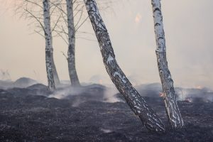
Pyregence is developing a protocol for sampling forest fuels and integrating the information into a thematic map. We’re using satellite imagery and aerial LiDAR, combined with field measurements, to characterize vegetation types and the amount, size, depth, and nature of forest fuels in granular detail.