- Conduct Wildfire Simulations
- Optimize Weather Stations
- Weather Station Application
- Open Source Materials
- Pilot Upper-Air Profiler
Learn about the Pyregence project and the innovations we’re planning to fire risk models in order to provide more accurate wildfire forecasts.
We show you the framework we’ve built for our web-based tool (now in beta) and lay out our plans for the future. The webinar was recorded on June 18, 2021.
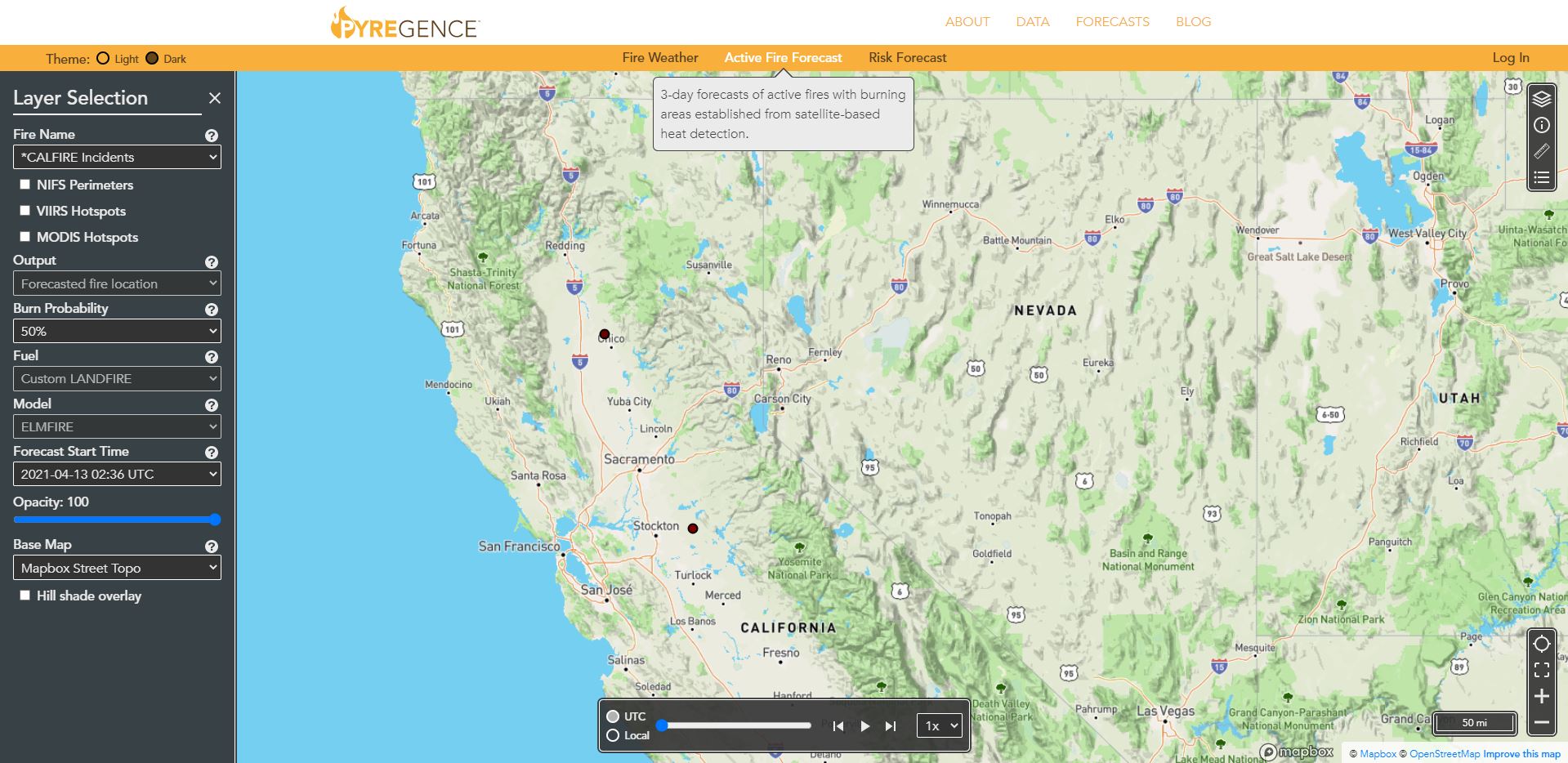
Our tool, open and available to all, currently forecasts:
YOUR HOSTS
Most fire models are decades old and cannot accurately predict how fires will behave under current conditions. Today’s climate is hotter and drier, extreme weather events happen more frequently, and forests are laden with fuel from drought-killed trees.
Improving wildfire behavior forecasting requires a better understanding of the science of how forest fuels burn, the types and amount of fuels available in California’s wildlands, and the weather conditions that drive fast-spreading fires.
Two teams within Pyregence—the Extreme Weather and Wildfire Team and the Fuel Mapping and Fire Physics Team—are conducting groundbreaking research that is transforming our understanding of wildfire behavior.
Building on that body research, the Fire Forecasting Team will be able to feed a more advanced set of data into its forecasting models.
Our models will incorporate higher-resolution inputs on vegetation and fuel, more frequent weather observations, and improved methods of predicting how active fires spread through wind-blown embers.
Our scientists are in the process of introducing eye-catching new features that will make our tool even more useful.
First, maps are now available in 3D, which is helpful given that terrain plays an important role in the direction and speed of wildfire spread.
“People can go in and spin things around, just as they would in Google Earth,” Lautenberger says. “This gives users a more intuitive, visual understanding of how the slope of the land and other terrain features interact with wildfire.”
Users also now have access to real-time photographs from Alert Wildfire, a network of hundreds of cameras that continuously capture images of high-risk California landscapes. When the “Show Cameras” option is selected, camera icons appear on the map. Clicking on an icon reveals an image of the landscape in that location—making it possible to detect fire ignitions and to monitor the status of active fires.
These cameras make wildfire real in a way that model animations simply can’t.
“Being able to see images of the fire in real time is important,” Lautenberger says. “It provides situational awareness that you don’t necessarily have when you’re just looking at a fire forecast from an overhead view.”
In addition, a new “Match Drop” feature allows users to ignite hypothetical fires by selecting a location, date, and time for the fire to start. The tool then simulates the hourly predicted growth of the fire on the landscape over a 72-hour period.
These models can take a couple of minutes to run to completion, so be patient—there’s a lot of computation going on behind the scenes!
Expect even more new features and functionality from the Pyregence tool in coming months.
“We’ll be adding real-time weather-station observations,” Lautenberger says. “You’ll be able to query a particular area and see what the weather is based on observations that were taken just a few minutes ago.”
The tool was developed on open-source principles, with code and data freely available, so “you can look under the hood and see what’s going on,” Lautenberger says.
But he emphasized that the tool is built not for tech experts but for anyone who needs an intuitive, easy-to-use tool to learn about wildfire forecasts.
“Being able to see information about where a fire is and where it’s forecasted to go has a clear utility to anybody that lives where there are wildfires—or has loved ones who live there,” Lautenberger added.